OTHER TX PROJECTS
QUICK LINKS
USGS IN YOUR STATE
USGS Water Science Centers are located in each state.
|
Geodatabase Development for the Panhandle Groundwater
Conservation District, White Deer, Texas
Downloads:
ArcMap Geodatabase Demo (.ppt)
MS Access Geodatabase Demo (.avi) |
(.zip)
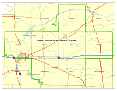
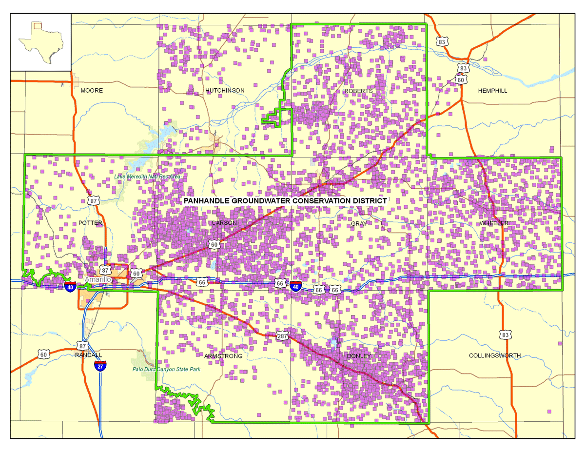
Figure 1. PGCD boundary consists of Carson, Donley,
Gray, Roberts, and Wheeler counties, along with parts of Armstrong,
Hutchineson, Hemphill, and Potter counties.
The Panhandle Groundwater Conservation District (PGCD), located in White Deer, Texas, consists of Carson, Donley, Gray, Roberts, and Wheeler counties, along with parts of Armstrong, Hutchinson, Hemphill, and Potter counties (fig. 1). The district was created by the Texas legislature in 1955 and it began operating in 1956 in portions of Gray, Carson, Potter, and Armstrong counties. Elections were held in 1988, 1991, 1994, 1997, and 2000 to annex the remaining portions of the District within the present boundaries. Amarillo and other communities in the area rely on information from PGCD for aquifer management and protection efforts.
Panhandle Groundwater Conservation District's aerial extent is 6,309 square miles. The District's economy is dominated by agricultural and petrochemical production. The agricultural income sources include beef cattle production, wheat, corn, peanuts, soybeans, sunflowers, hay crops, and cotton. Petroleum production contributes significantly to the economy, and chemical, manufacturing, and nuclear weapons industries are also located in the District.
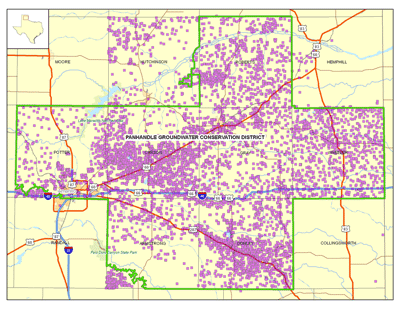
Figure 2. Well locations (noted in purple) within PGCD boundary.
Over 4,400 irrigation wells are within PGCD boundaries, 1,873 of which are active, capable of producing water to meet the needs of the agricultural community. The District has 185 municipal or public supply wells, and 251 wells for industrial use and oil and gas secondary recovery (water flood) operations. The remaining 922 wells are registered, non-permitted water supplies for household and livestock consumption (fig. 2, well locations noted in purple)(www.pgcd.us, 2007).
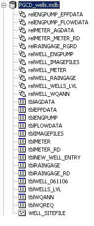
The U.S. Geological Survey (USGS), in cooperation with the PGCD, reconstructed the original PGCD geodatabase to help effectively input and manage data, thereby allowing PGCD to distribute both static and dynamic information to both stake holders and the public. Both spatial and tabular data were presented in one geodatabase for data input and output. A data system dictionary containing definitions of coded values was also developed for data input.
What is a Geodatabase?
Environmental Systems Reach Institute, Inc. (ESRI) defines a geodatabase as collection of geographic datasets for use by ArcGIS. There are various types of geographic datasets, including feature classes, attribute tables, raster datasets, network datasets, topologies, and many others. With geodatabases, geographic data can be manipulated to represent the real world using a geographic information system (GIS) to produce maps, interactive queries, and various types of spatial analyses. The geodatabase is a framework behind which the geographic data can be used to create relationships among related spatial features.
Geodatabases come in two different ESRI formats: Personal geodatabase and ArcSDE. The Personal geodatabase, backed by an Microsoft (MS) Access database, is intended for use in small groups and is limited to single-user editing for all geographic data. The ArcSDE geodatabase is more robust database, allowing large groups of users to access and edit the geographic data through version-based work flows.
PGCD Geodatabase
PGCD was utilizing a Microsoft Access powered ESRI ArcGIS 9.1 personal geodatabase. The geodatabase included point, line and polygon spatial features some of which included well locations, boundaries (both municipal and state), and water resource locations. In addition, the geodatabase contained tabular information which was related to the spatial features. The tables of the geodatabase included records of both a governmental and commercial nature.
The original PGCD geodatabase was a legacy geodatabase that had been used and managed by several different PGCD employees before this project evolved. This fact made it essential to thoroughly investigate the common data management practices of the geodatabase, as well as gain a full understanding of the daily usage of the geodatabase. Working together with PGCD, detailed descriptions were documented for the contents of the entire geodatabase. In addition to having clear and concise descriptions for all the contents of the geodatabase, it was essential to gain a full understanding of the internal relationships of the geodatabase and also understand how PGCD was querying the data to produce reports.
Understanding that the end result of this effort was to produce a geodatabase which was both user-friendly and powerful enough to satisfy the everyday needs of PGCD, USGS developed a flexible structure that could be expanded as needed. Creation of a new geodatabase meant the development of a new geodatabase structure which was intuitive, and also flexible for expansion.
Methods
- Transfer data from original PGCD geodatabase to new geodatabase structure designed by USGS.
This step included issues pertaining to field data types from the original geodatabase. Many of the fields in the original geodatabase contained data which was stored as text elements that should have been stored as numerical values. Converting these data and subsequently storing them as numerical values gave the end user the ability to efficiently query the data. In addition, fields containing dates were converted to a "date/time" field, also improving the querying of dates.
A standardized naming convention was established for field names in the geodatabase. Each field in the geodatabase followed this structure – AbbreviatedName_Suffix. For example, the field "well drill date" was renamed "drill_dt", and the field name for "well depth" was changed to "well_depth_va". The standardization of field names in the geodatabase helped organize the data, and improve understanding of the contents of each field.
The simplified and standardized data was then loaded into the new geodatabase structure and compared to the original geodatabase to assure that no information was lost during the transition. Changes to the geodatabase structure were noted and approved by the cooperating agency throughout the effort.
- Spatial relationships and coded-value domains were established in the geodatabase
Relationships were created in a geodatabase to establish connectivity between spatial features and the tabular information. This allows an object in one feature class to gain access to the attributes of an object in another feature class. Establishing relationships between data will allow you to select (or identify) a well location within the geodatabase, and provide the ability to view the related information from another data table (i.e. well water level measurements). The related attributes may be used in queries, reports, and other functions.
Coded-value domains were used for any data commonly stored as an abbreviated value, like land use codes. For our purposes the PGCD data provided a significant amount of coded data. Domains display "heads-up" full descriptions in each field, while storing only the coded value in the attribute table. This allows for improved database efficiency by keeping length of field values stored in the database at a minimum.
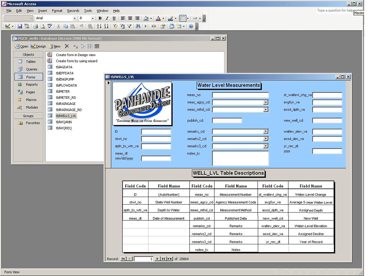
- Data entry forms were built into MS Access to streamline day to day operations
PGCD had several employees doing data entry into the geodatabase for regularly updated fields, such as well water level measurements, meter readings, and well ownership data. To streamline these efforts, the USGS developed data entry forms within MS Access to assist with this effort (fig. 3). Data entry forms included pull-down menus for coded value fields in an effort to reduce data entry errors. In addition, fields were restricted by data type (numeric values or text values) to prevent issues during data input.

Figure 3. MS Access data entry form for water level measurements.
- Data dictionary for new geodatabase created
A data dictionary was developed in order to explicitly define the contents of the tables in the geodatabase. The data dictionary provides the following: field name, field code, field definition, and coded-domain values (table 1).
|
Field Code |
Field Name |
Definition |
Codes (if applicable) |
| stwl_no |
State Well Number |
Unique well record number stored and defined in the Texas
Water Development Board Groundwater Data System. |
|
| dpth_to_wtr_va |
Depth to Water |
Static depth to water in feet measured from the measuring
point for wells under static conditions. |
|
| meas_dt |
Date of Measurement |
Date that a water level measurement is made. |
[M/DD/YYYY] |
| meas_no |
Measurement Occurrence |
Denotes the number of times a well
was measured for a water-level. |
|
| meas_mthd_cd |
Measurement Method |
Code indicating the method used to measure the water level |
1 – steel tape
2 – electric line
3 – air line
4 – recorder
5 – pressure gap
6 – logging sonde
7 – unknown
8 – other |
Table 1.
Results
The final product was a Microsoft Access powered ESRI ArcGIS 9.1 personal geodatabase that contained one feature class of well locations, and twelve tables of related information. Related tables included information pertaining to water quality, well construction, flow data, meter readings, and rain gauge information. Along with the spatial and tabular information, the geodatabase contains eleven relationship classes and numerous coded-value domains.
Additional deliverables included: MS Access data entry forms, the data dictionary, and one additional geodatabase of ancillary GIS datasets, geology, cultural boundaries, topographic raster dataset, and aerial imagery. Onsite training and help-desk services were also provided to PGCD.
For more information about PGCD please see -
www.pgcd.us
Contact us about this program
|